

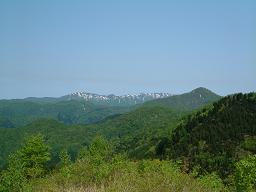
Mt. Futatsumori
Mt. Futatsumori Trailhead (located in Happo Town)
Distance:3.2 kilometers
Duration:1 hour (one way)
Mt. Futatsumori (1,086 m), located in Fujisato, Akita Prefecture, is the nearest mountain to the Shirakami Sanchi core zone. This trail leads through the buffer zone (the area that surrounds the core zone of the Shirakami Sanchi World Heritage Site) to the top of the mountain, which is on the border of Akita and Aomori prefectures. The road to the trailhead was once a logging road and was planned to cut through forest into Aomori Prefecture, but construction was stopped by environmental activists in 1990.
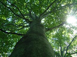
The name Futatsumori literally means “two forests,” and the mountain’s ecosystems support a wide diversity of plants and animals.Parts of the mountainside were once clear-cut for timber and the lower foothills of the mountain are still mostly used for tree farming. But as the trail leads closer to the Shirakami Sanchi core zone, the environment gradually changes into a beech forest with an undergrowth of bamboo grass. Many of the forest’s beech trees have curved trunks. Young beeches are bent by the weight of heavy snowfalls, but as the trees grow they become strong enough to bear the weight of the snow and send their trunks straight upward. The forest floor is carpeted by various shrubs and herbaceous plants, including forked viburnum (Viburnum furcatum), Asian fawn lily (Erythronium japonicum), and several species of rhododendron.
Summit of Mt. Futatsumori
This 1,086-meter peak on the border of Aomori and Akita prefectures overlooks the core area of the Shirakami Sanchi World Heritage Site. Northeast of Mt. Futatsumori lies the untouched heart of Shirakami Sanchi’s old-growth beech forest: an 8,000-year-old ecosystem almost entirely free of human impact.
From the top of Mt. Futatsumori, Mt. Kodake (1,042 m) and Mt. Fujisato-Komagatake (1,158 m) can be seen in the east; and Mt. Shirakami (1,232 m) and Mt. Mukai-Shirakami (1,243 m), the tallest peaks in the region, are visible in the northwest. On clear days, visibility extends as far west as the Sea of Japan, and to the distinctive cone of Mt. Iwaki (1,625 m) in the northeast. Vegetation around the summit includes Erman’s birch (Betula ermanii), Chishima bamboo grass (Sasa kurilensis), and miyamanara (Quercus crispula var. horikawae), an alpine variety of oak tree.
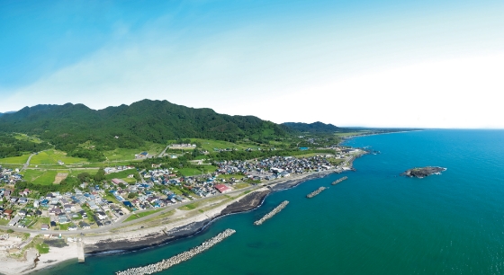
Mt. Tomeyama (located in Happo Town)
Less than 180 meters high, Tomeyama is one of the lowest mountains in the region. In Japanese tome means to stop or prohibit, and logging on this mountain has been prohibited for over 300 years. The reason why logging was stopped on the mountain is unknown, but it is likely that the people living here realized the tree’s importance to the local watershed. The slopes are covered with an old-growth forest of beech and oak, including some huge trees over 300 years old. The beech trees growing here show a distinctive whitish tint to their trunks, typical of beeches that grow at lower altitudes. Beeches are particularly important to the environment of Shirakami Sanchi, they transport rainwater into the water table. A walking path runs across the mountain, but visitors are required to hire a local guide.
* This English-language text was created by the Japan Tourism Agency